AI Infrastructure Monitoring from Satellite Imagery
Governments own enormous amounts of physical infrastructure but usually discover problems through scheduled inspections, citizen complaints or failures. Build a system that watches an entire jurisdiction from above and automatically creates maintenance tickets when it detects something changing: a deteriorating road, vegetation approaching power lines, erosion near infrastructure, an expanding illegal dump or water accumulating somewhere it shouldn’t. Satellite imagery becomes the sensor while AI becomes the inspector. A county could wake up Monday morning to 37 automatically generated work orders ranked by estimated economic and safety consequences rather than sending employees around looking for problems.
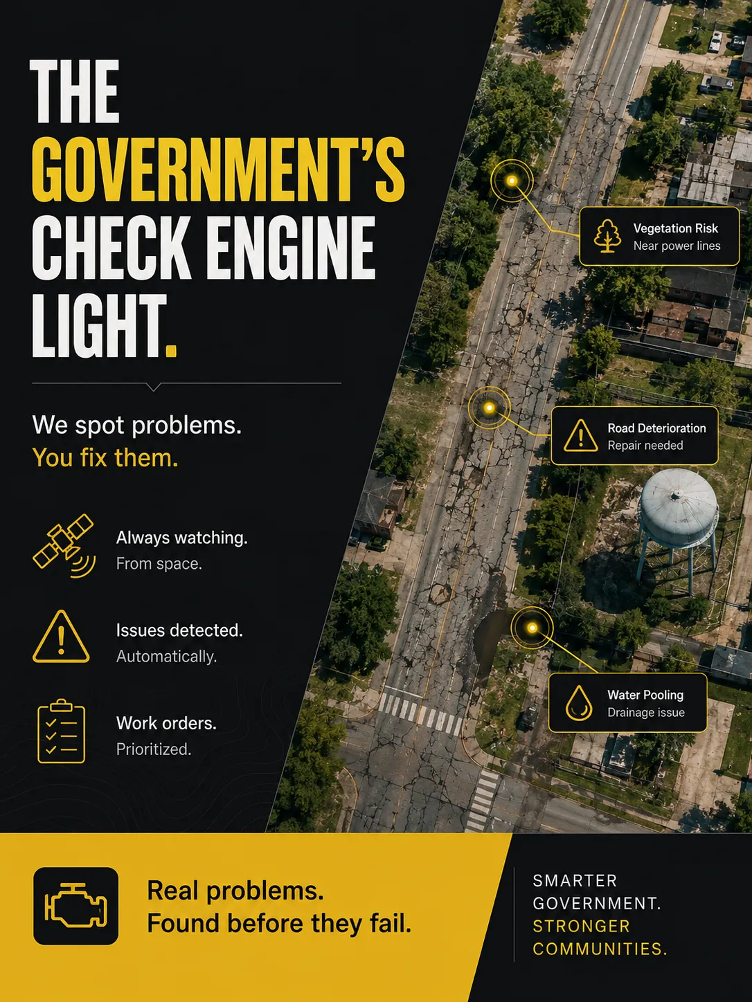
Description
No additional description provided.
The Pitch
Turn public infrastructure maintenance from a reporting system into an observation system. Today, governments mostly manage assets through memory, routes, and complaints, which means the loudest or most visible problems often get attention before the most consequential ones. A jurisdiction-wide visual record changes the default: every road edge, drainage ditch, bridge approach, utility corridor, and parcel becomes part of a continuously monitored surface. The important shift is not that satellites can “see” things, but that governments could finally compare the same place against itself over time at scale.
The strongest business insight is that most infrastructure problems are cheap when they are early and expensive when they are obvious. A blocked culvert, spreading shoulder erosion, or encroaching vegetation is not dramatic at first; that is exactly why it is missed. But small physical changes compound into emergency repairs, liability claims, outages, road closures, and political embarrassment. A system that reliably finds weak signals before they become public events creates value not by replacing workers, but by moving their attention to the narrow slice of geography where time matters most.
This would also create a new kind of administrative truth. Cities and counties often know their assets imperfectly: records are outdated, departments see only their own responsibilities, and private contractors report what they were hired to inspect. Overhead change detection becomes a neutral, recurring audit of the physical world. That matters because maintenance budgets are always contested. A ranked queue backed by visible evidence gives public officials a defensible way to say why one repair came before another, and why ignoring a known risk was no longer acceptable.
The business could be unusually sticky because the longer it watches a place, the more useful it becomes. The baseline is the product. Once the system understands seasonal patterns, normal construction activity, recurring flood zones, vegetation cycles, and the local history of repairs, it can distinguish noise from risk with increasing confidence. A competitor cannot instantly recreate that institutional memory, because the valuable asset is not just imagery or models; it is years of interpreted change tied to outcomes in a specific jurisdiction.
The deeper opportunity is that governments do not lack work orders; they lack a trustworthy way to decide what deserves to become one. A company that supplies that judgment would sit upstream of labor, materials, inspections, and emergency response. It would make maintenance less reactive without requiring governments to become technologically sophisticated themselves, which is often the difference between a clever tool and a durable public-sector business.